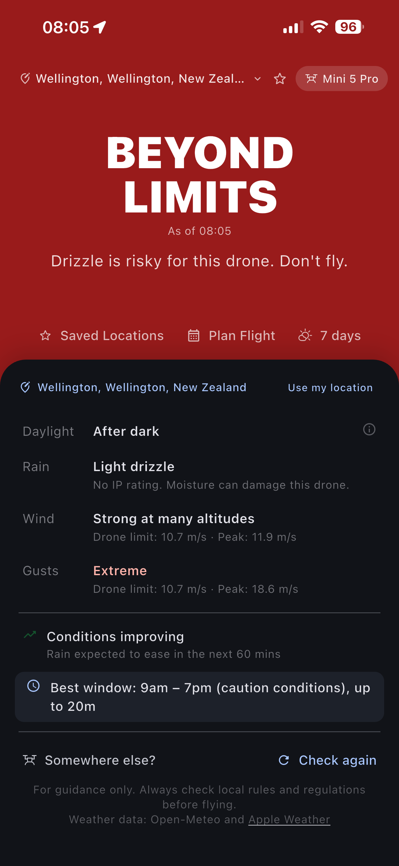
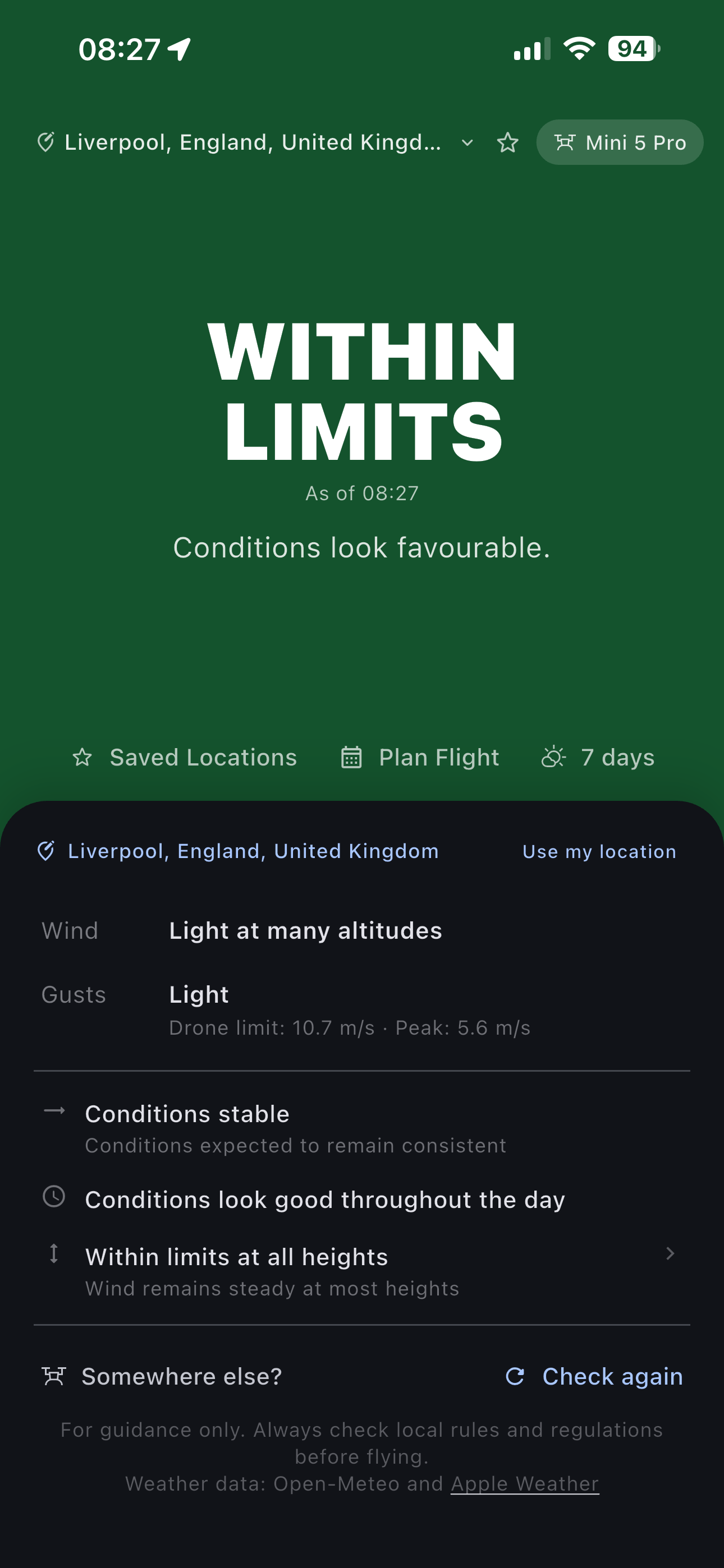
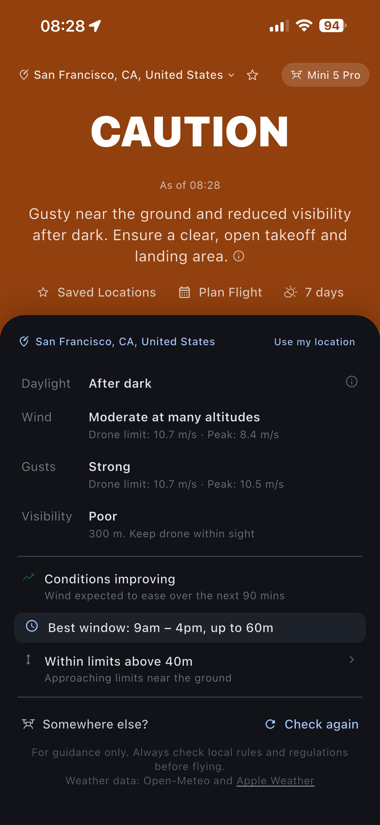
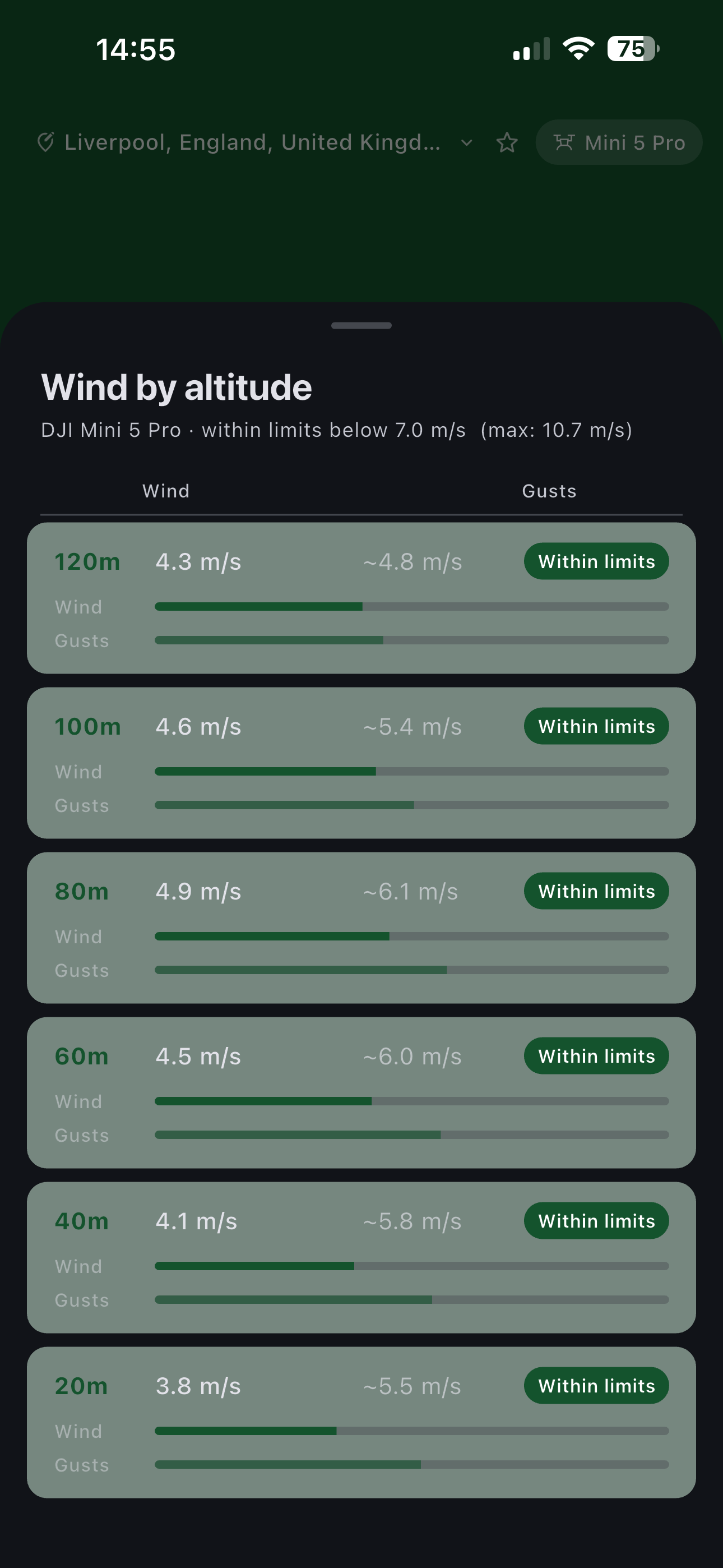
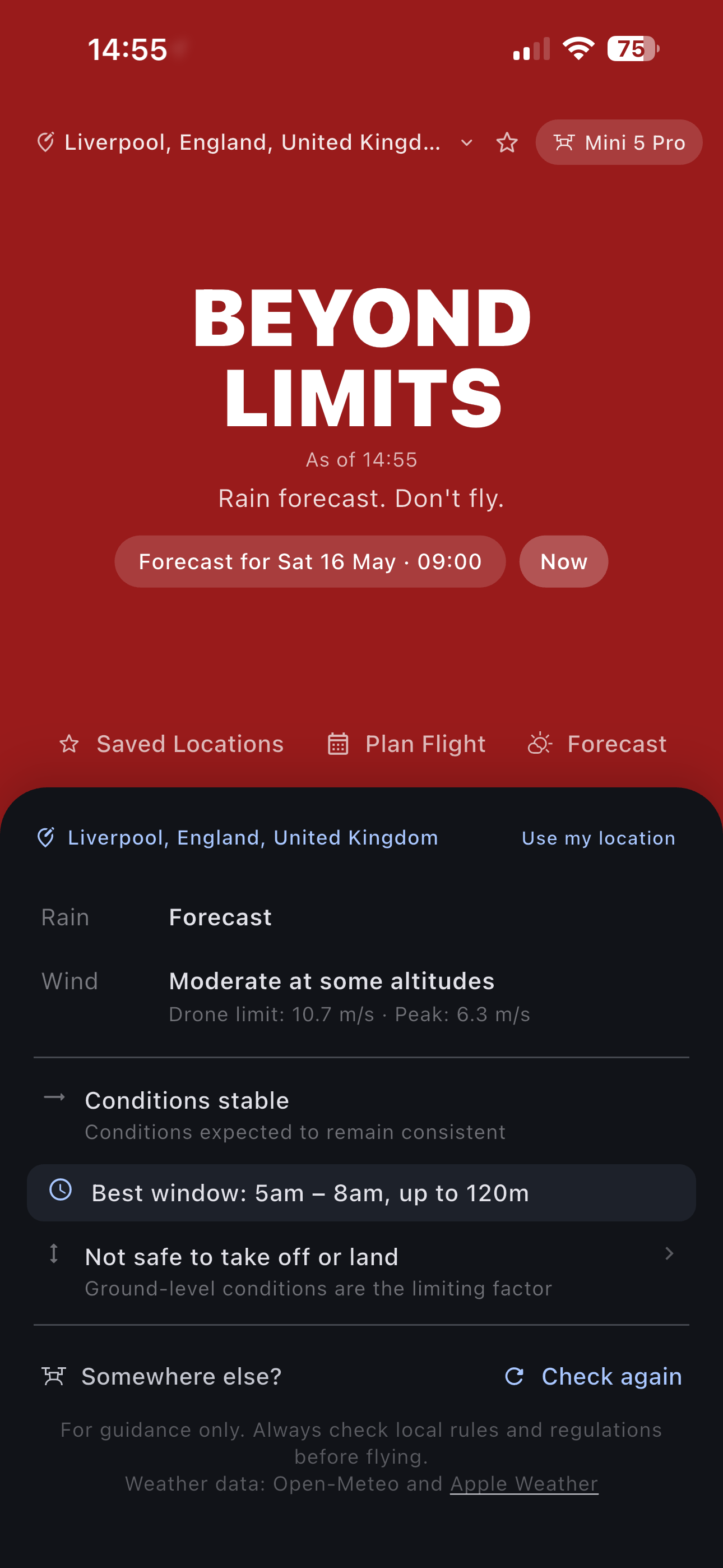
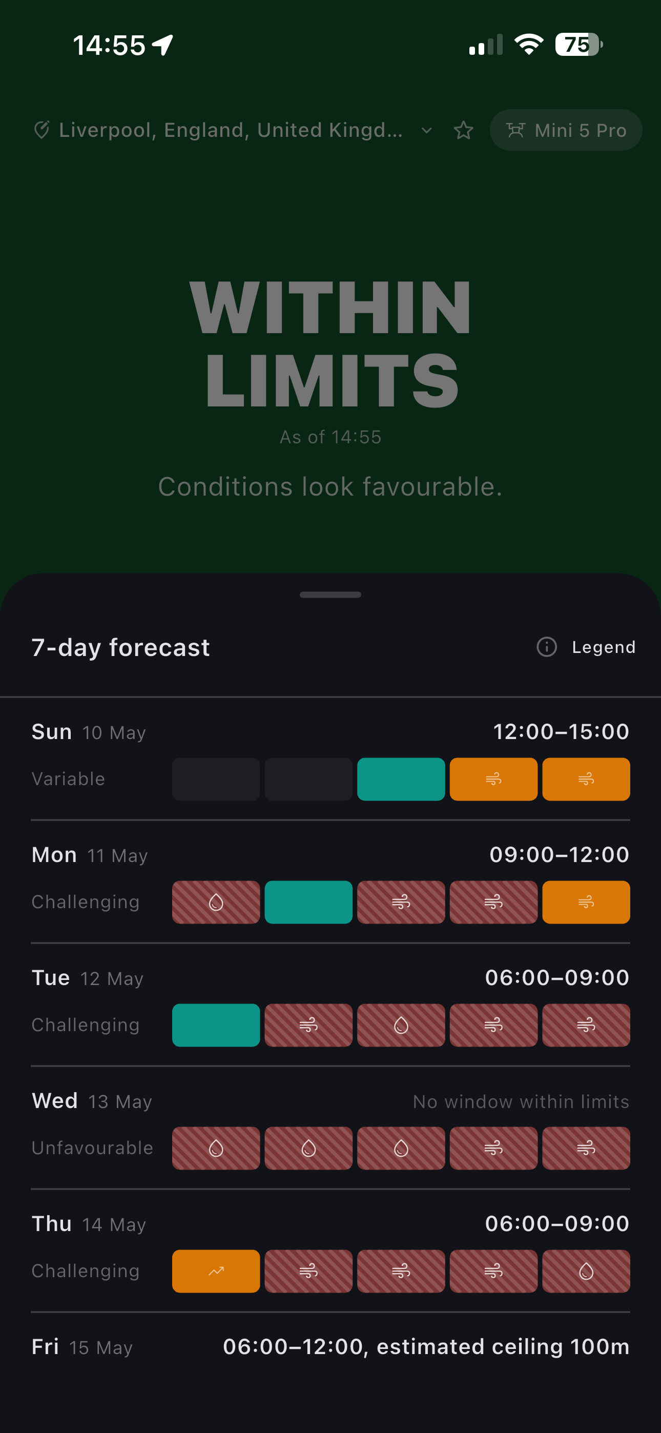
Ground-level weather only tells part of the story. Wind and conditions at flight height can be completely different.
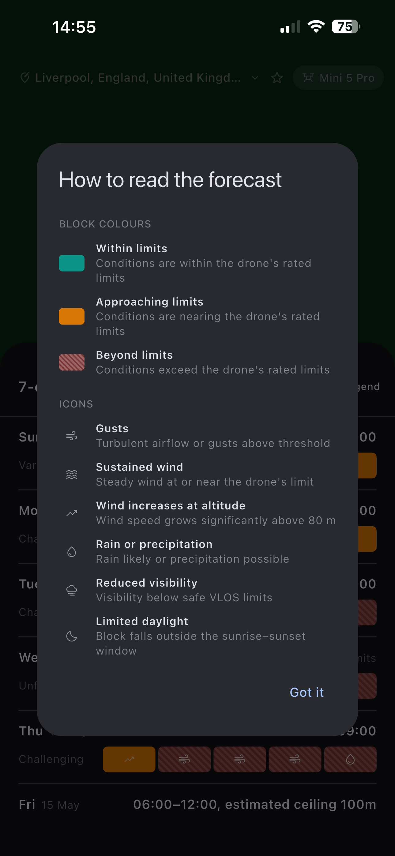
Can I Fly checks conditions at actual drone altitude and compares them against your drone's operating limits, helping you avoid risky launches before takeoff.
Most apps stop at weather data. Can I Fly tells you whether you're within limits, approaching them, or already past them. So you know exactly where you stand before you take off.
Other weather apps
Can I Fly?
BEYOND
LIMITS
Gusts exceed your drone's
operating limits at this altitude.
Flying conditions aren't simply safe or unsafe. Can I Fly helps you understand how close you are to the edge before takeoff.
Raw weather data, translated into a clear answer: within your drone's limits or not.
Conditions evaluated against your drone's actual operating limits, not generic benchmarks.
What you feel on the ground tells you very little about what's happening 100 metres up.
What it does
Most weather apps report surface conditions. Can I Fly models the conditions your drone will actually fly through.
Forecasts adjusted for real flight height, not just ground-level readings from a nearby weather station.
Check conditions for your planned flight window before you pack the car. Avoid wasted journeys and bad surprises on site.
See how gust behaviour changes with altitude, so flight decisions are based on actual conditions aloft, not assumptions from the ground.
By comparing forecast conditions against your drone's operating limits, Can I Fly helps reduce the kind of preventable incidents that lead to insurance claims.
How it works
Step 01
Tell Can I Fly where you plan to fly and how high. That's the forecast you'll get, not a generic surface reading for the nearest town.
Step 02
Choose a time slot that suits your session. Wind and weather are shown hour by hour so you can find the best window, or decide it's not the day.
Step 03
Head out knowing the actual picture at altitude. No nasty surprises, no second-guessing, no unnecessary calls on your policy.
Premium Features
Built for people who fly regularly and want deeper insight into the conditions their drone will actually face.
Altitude wind profile
Wind speed and estimated gusts from 20m through to 120m, assessed against your drone's operating limits at each level. The ground reading tells you very little about what's waiting 80 metres up.
Flight window planning
Can I Fly identifies your optimal flying window for the day, down to the hour. Leave knowing there's a good window waiting, or make the call before you've packed the car.
Seven-day forecast
Conditions across seven days at a glance, colour-coded by outcome. Spot the good flying days immediately and rule out the difficult ones without working through the numbers.
Condition detail
Every condition flag explained: gusts, sustained wind, altitude increases, precipitation, visibility, and daylight limits. So the outcome makes sense, not just the result.
Also included
Can I Fly is finishing up. Join us on both platforms when we launch.